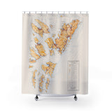
Created from the original hand-drawn plausible fictitious map art of David Nuttall @Artimaps.
Add some mappy flair to your bathroom and get lost in the larger-than-life details, no magnifying glass needed.
.: 100% Polyester
.: One side print
.: Hooks not included
Map Details for Kjempsavor Ayars – set in North Atlantic
A very detailed map depicting an entire island nation located midway between the Faroe Islands and the Shetland Islands in the North Atlantic. The research for this map was one of the more intense, as I wanted to place the islands on a realistic seamount close to the Faroe-Shetland Channel and create an island nation that had a distinct history that related to other islands in the area. This included history and language considerations as well as determining the financial and economic aspects to the country.


